 Wei Zhang
- What Is the Exact Altitude of Mount Siguniang?
- How Does the Altitude Affect Your Visit?
- Best Time to Visit Mount Siguniang for Altitude Considerations
- How to Prepare for the Altitude: Tips from a Local Guide
- Getting to Mount Siguniang: Routes and Altitude Changes
- Trail Difficulty and Altitude: Which Peak Should You Choose?
- Frequently Asked Questions about Mount Siguniang Altitude
I've lost count of how many times a guest has asked me, "Is the altitude really that bad?" — right before we hit the trail. And I always give the same answer: It depends on how you prepare. Mount Siguniang, known locally as the "Four Sisters," is one of the most accessible high-altitude destinations in Sichuan. But its elevation — from 3,200 meters at the base to 6,250 meters on the highest peak — demands respect. Let me walk you through what you actually need to know.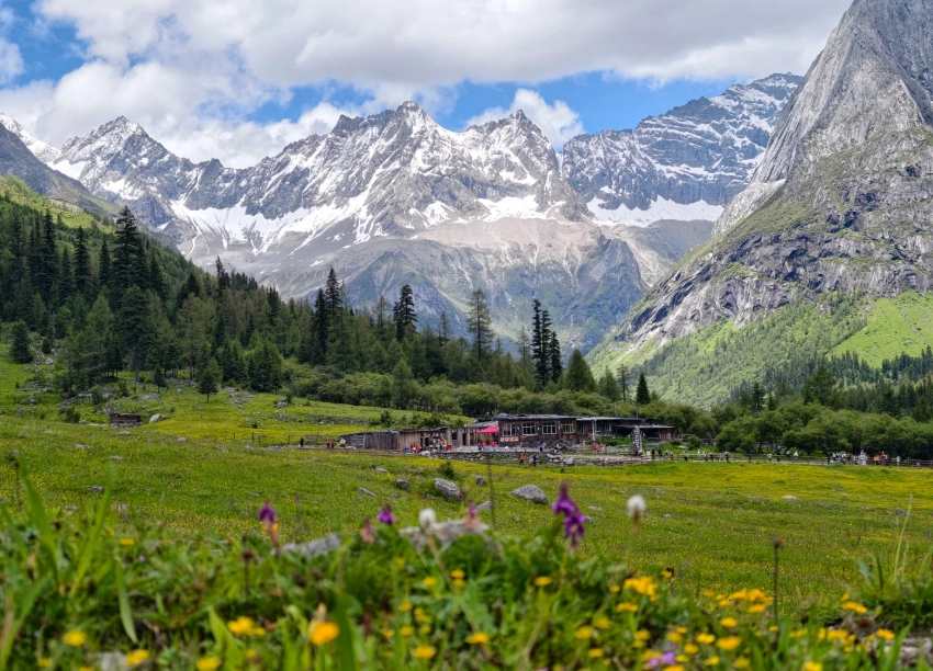
What Is the Exact Altitude of Mount Siguniang?
The range consists of four main peaks, each with a distinct elevation. The table below gives you the numbers — but remember, it's the rapid gain that hits you, not just the final number.
| Peak | Altitude (meters) | Difficulty | Typical climbing duration |
|---|---|---|---|
| Big Sister (Dafeng) | 5,025 | Moderate (trekking) | 2-3 days |
| Second Sister (Erfeng) | 5,276 | Moderate+ | 3-4 days |
| Third Sister (Sanfeng) | 5,355 | Advanced (technical) | 4-5 days |
| Youngest Sister (Yaomei Feng) | 6,250 | Extreme (expedition) | 6-10 days |
But here's the catch — you start your day at Siguniang Town, which sits at roughly 3,200m. Most people drive directly from Chengdu (500m). In just 4 hours, you jump from near sea level to 3,200m, and then you're expected to sleep there. That's a recipe for headache and nausea.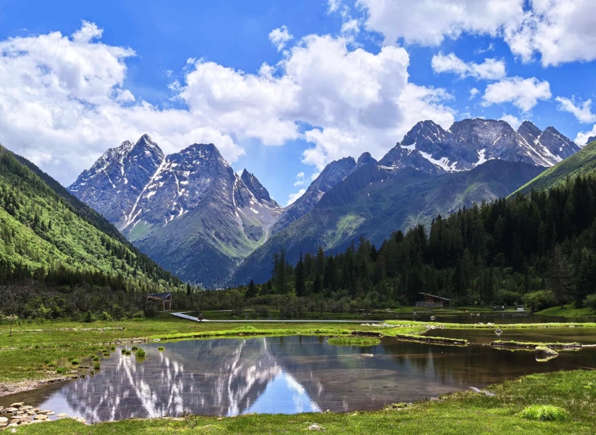
How Does the Altitude Affect Your Visit?
Altitude doesn't just mean you'll get winded faster. It messes with your sleep, appetite, and decision-making. I've seen hikers make stupid mistakes — like leaving their water bottle behind — simply because their brain wasn't getting enough oxygen.
Symptoms at 3,200m-3,500m often include mild headaches, loss of appetite, and shortness of breath. Above 4,500m — where most of the real hiking happens — the risk of Acute Mountain Sickness (AMS) jumps significantly. If you feel nauseous, dizzy, or have a persistent headache that doesn't respond to ibuprofen, descend immediately. There's no shame in turning back. I've canceled many summit attempts because safety comes first.
Best Time to Visit Mount Siguniang for Altitude Considerations
Season directly affects both temperature and oxygen levels. Summer (June–August) brings warmer days but also afternoon thunderstorms that can trap you at high camps. Autumn (September–October) is my personal favorite: stable weather, clear skies, and lower risk of rain — which means safer climbing conditions.
Winter (November–March) is brutal. Temperatures at base camp drop to -20°C, and deep snow makes trails treacherous. Spring (April–May) is windy and dusty; many guided trips are suspended due to avalanche risk on higher peaks. For a first-timer, target late September to early October. The autumn colors are stunning, and the air is still relatively warm (around 10-15°C during the day at base).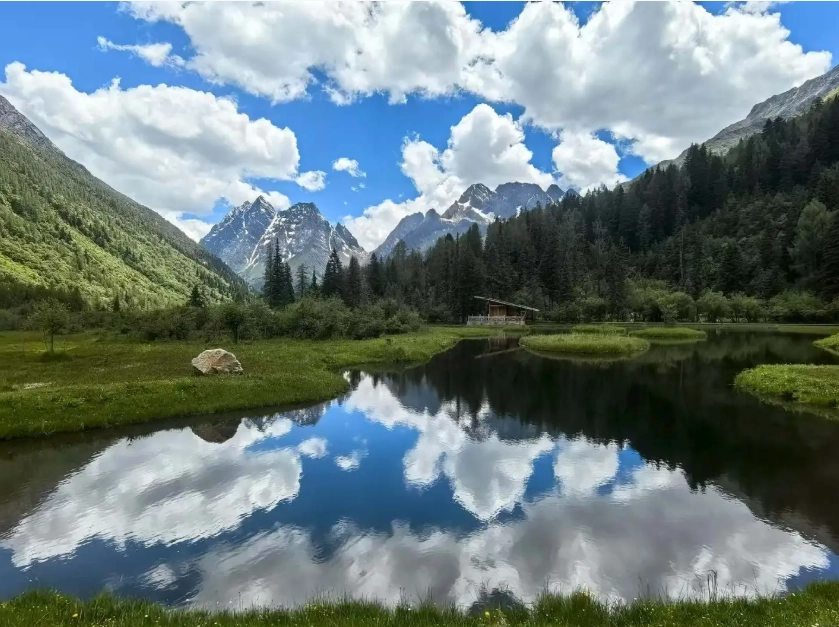
How to Prepare for the Altitude: Tips from a Local Guide
Over the years, I've developed a checklist that my clients swear by. Here's my no-fluff advice:
- Spend 2 nights in Chengdu (500m) before heading to the mountains. I know it's tempting to rush, but your body needs time to adjust to even mild altitude. Use those days to explore the city and eat hotpot.
- Arrange a stopover in Wolong Valley (around 2,000m) on the way. Most buses don't do this, but if you hire a private driver (about 600-800 CNY), you can ask to stop for lunch and a short walk. It makes the altitude transition smoother.
- Start hydrating two days before departure. Not just water — add electrolyte packets. I use the local brand "Bao Kuang Li" (easily found in any pharmacy). Avoid alcohol completely until you're back down.
- Bring acetazolamide (Diamox). Get a prescription from your doctor before traveling. I always carry a spare blister pack. Start with 125mg twice a day, beginning 24 hours before ascending above 3,000m.
- Plan your first day at Siguniang Town as an acclimatization day. Walk slowly around the town, visit the Shuangqiao Valley scenic area (max altitude 3,800m), but don't go higher. Rent a portable oxygen can (20-30 CNY) just in case — they're sold at the pharmacy near the bus station.
Getting to Mount Siguniang: Routes and Altitude Changes
The only realistic gateway is Chengdu. From there, you have two main options:
Public bus from Chengdu Chadianzi Bus Station: Daily at 6:30am and 9:00am. Ticket price is 95 CNY. The ride takes about 4-5 hours, with one rest stop at Wenchuan (altitude 1,300m). You'll arrive at Siguniang Town's main square. Warning: The bus drops you off at the start of the altitude climb — don't be fooled by the pleasant temperature. Once you step off, you're at 3,200m.
Private transfer: I always recommend this for groups of 3+. Cost is around 150-200 CNY per person if shared. The advantage: you can ask the driver to stop at the Wolong Panda Base (altitude 1,800m) for a 30-minute break. Additionally, the driver can drop you at your hotel entrance, saving you from hauling luggage uphill.
Trail Difficulty and Altitude: Which Peak Should You Choose?
First-timers should stick to Dafeng (Big Sister). It's a non-technical hike, though the altitude makes it feel much harder than a typical mountain trail. You'll start at the Changping Valley entrance (3,400m), hike to the base camp at 4,300m (about 5-6 hours), then summit the next morning around 3am. The sunrise from the top is worth every heavy breath.
Erfeng (Second Sister) involves scrambling over loose rocks and a short exposed ridge. Not recommended unless you've done at least one 5,000m+ peak before. Sanfeng and Yaomei require technical climbing gear, ropes, and a certified guide — don't even think about going solo.
I came here expecting beautiful mountains, but I got so much more. The altitude actually made the whole trip feel more immersive—the crisp, thin air makes the colors pop, and the stars at night from the campsite are unreal. I'm not an elite hiker, but with proper pacing and local guides, it was totally manageable. The locals are super helpful too. This place changed my perspective on what 'high altitude' really means. Would go back in a heartbeat.
If you love a challenge, this is your mountain. I tackled the Siguniang altitude head-on and it was brutal but so rewarding. The thin air makes your legs feel like lead, but every time you look up at those towering cliffs you forget the pain. I managed to reach the glacier viewpoint at 4,500m—hardest thing I've ever done physically, but the sunrise over the mountaintops was pure magic. Bring diamox if you're prone to altitude sickness! Five stars without hesitation.
This place is absolutely unreal! The altitude adds a whole new dimension to the hike—every step feels earned. I was nervous about the elevation, but taking it slow and drinking lots of water helped a ton. The view from the Dafeng base camp at 3,800m is like standing on top of the world. Snow-capped peaks in every direction, and the silence up there is profound. A once-in-a-lifetime experience. 100% recommend for adventurous souls!
Great experience overall, but the altitude is no joke. I'm a regular hiker and I still felt lightheaded during the first few hours. The scenery is otherworldly—those jagged granite peaks against the clear blue sky are breathtaking. My only complaint is that the trail markers are sparse near the higher passes, and with thin air it's easy to get disoriented. Bring plenty of water and take it slow. Would recommend for fit travelers who know their limits.
Honestly, the altitude here caught me off guard. I've done other high-elevation treks before, but Siguniang's steep ascent at over 4,000m really hit me with headaches and shortness of breath. The views are undeniably majestic, but I spent half the time just trying to catch my breath. If you're not acclimated, prepare for a rough first day. I wish there were more oxygen stations or rest huts along the main trail. Still, the raw beauty of the peaks is something else.