 Tao Xu
Jump to the Good Stuff
Why This Map Matters
I’ve been guiding groups to Lantau Island for nearly a decade. And every single time, I see the same confusion: tourists staring at their phones, swiping between apps, trying to figure out where the cable car drops, how to find the Buddha, and why their credit card got rejected at the ticket counter.
This isn’t a generic “map” with dots and lines. It’s a decision map — telling you exactly where to walk, when to buy, and what to skip. The Tian Tan Buddha & Ngong Ping 360 map you need isn’t on paper. It’s in the timing, payment method, and route you choose.
Here’s the catch: most online guides tell you to take the cable car both ways. But I’d say: only take it one way unless you enjoy queues longer than the Buddha’s arm. Let me show you how.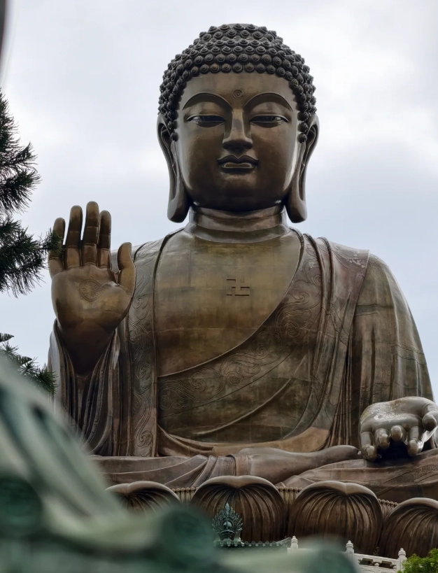
Getting There – Don’t Trust Google Maps
First real talk: Google Maps is useless inside mainland China, and even in Hong Kong it often suggests walking routes that don’t exist. Use Apple Maps or Citymapper. For taxis, Uber works well in Hong Kong (it’s the one place in China where Uber is active).
Your starting point is usually Tung Chung. From Hong Kong Island or Kowloon, take the MTR Tung Chung Line to the terminal station — about 30–40 minutes from Central. Exit B leads straight to the Ngong Ping 360 terminal. Can’t miss it.
Address for your driver/ride-hail: Ngong Ping 360 Tung Chung Terminal, 11 Tat Tung Road, Tung Chung, Lantau Island. Show this: 昂坪360東涌纜車站, 大嶼山東涌達東路11號.
🚨 Pro tip: Arrive at the terminal by 8:45 AM at the latest. The cable car opens at 10:00 AM, but the queue starts forming by 9:15. If you roll up at 10:30, expect a 45–70 minute wait for the standard cabin.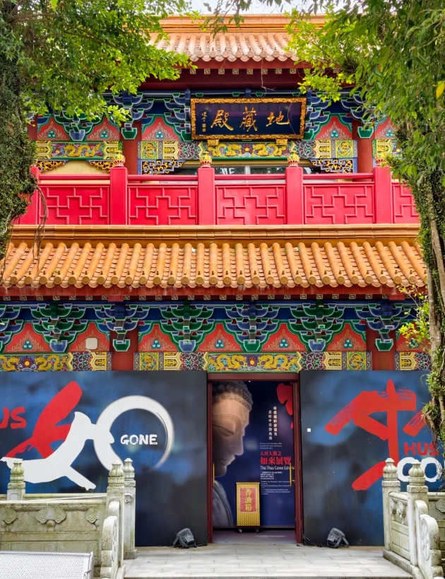
Tickets and Timing – Where Most Tourists Waste Money
Here’s a table that saves you real cash. Do not buy tickets at the counter — they charge full retail. Always pre-book online.
| Item | Standard Price (HKD) | Best Booking Platform | Notes |
|---|---|---|---|
| Ngong Ping 360 – Round Trip (Standard Cabin) | 235 | Klook or Trip.com (~210) | Valid for any day, skip counter queue by scanning QR. |
| Ngong Ping 360 – One Way (Standard) | 160 | Same as above (~145) | If you plan to bus back (only 20 min, saves 1+ hour). |
| Ngong Ping 360 – Crystal Cabin (Glass floor) | 315 round trip | Klook (~280) | Worth it if you’re not scared of heights. Book early, limited slots. |
| Tian Tan Buddha – Entry | Free | No booking needed | But the exhibition hall inside the statue costs 60 HKD (cash or Octopus). |
| Po Lin Monastery | Free | None | Donations accepted. |
⚠️ Payment reality: The ticket counter and most shops do NOT accept international credit cards directly. They take Alipay, WeChat Pay, Octopus, and Hong Kong cash (HKD). I’ve seen families turned away because they only brought Visa. Pre-load your Alipay with a foreign card — it works. Or carry at least 500 HKD cash for incidentals.
Now, let me save you money: buy a one-way cable car up, and take the bus down. The bus from Ngong Ping Village back to Tung Chung is route 23, fare 27 HKD, runs every 15 minutes. Total travel time: 20 minutes vs. cable car wait of 40+ minutes. You save money and time. Why don’t guides tell you this? Because they assume you want the “full experience.” But the full experience includes frustration.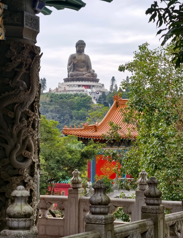
Ngong Ping Village – What’s Worth Your Time?
Ngong Ping Village is a theme-park-style plaza with souvenir shops, a walking model of the Buddha’s life, and “Chef’s Delight” — a mediocre food court. I’m not a fan. Skip the overpriced dim sum.
Instead, head straight to Po Lin Monastery’s vegetarian restaurant (walk left after exiting the cable car terminal). Their lunch sets cost about 100 HKD per person, and the food is surprisingly good. Try the “Buddhist Delight” — mock meat made from soy, served with lotus seed soup. Cash only (HKD).
Inside the village, the Walking with Buddha exhibition is free and air-conditioned — a good break if it’s scorching. But the real gem is the Tai O lookout point behind the bell tower. Most tourists don’t go there. Walk past the souvenir stalls to the end, climb a short staircase, and you’ll see the fishing village of Tai O in the distance. Quiet, peaceful, and Instagram-worthy.
Tian Tan Buddha – Climbing the 268 Steps
The Big Buddha sits at the top of 268 steps. Sounds exhausting, but it’s not. I’ve seen 70-year-olds do it in 10 minutes. The real challenge is the sun — there’s zero shade. Go before 11 AM or after 3 PM. At noon, the steps turn into a heat griddle.
At the top, you can walk around the statue’s base. The Buddha faces north, so morning light is best for photos. Bring a wide-angle lens — you won’t be able to step back far enough to get the whole statue with a phone.
To enter the statue’s interior exhibition (housing relics of Gautama Buddha), you need to buy a ticket at the small booth near the steps: 60 HKD, cash only. The exhibition is small but offers a glimpse into Buddhist culture. If you’re short on time, skip it.
🚨 Real talk about the monks: Sometimes monks from Po Lin Monastery bless visitors for a small donation (20–50 HKD). They don’t speak much English, but they gesture kindly. It’s a lovely cultural exchange — just don’t be pressured. A polite smile and “No, thank you” works.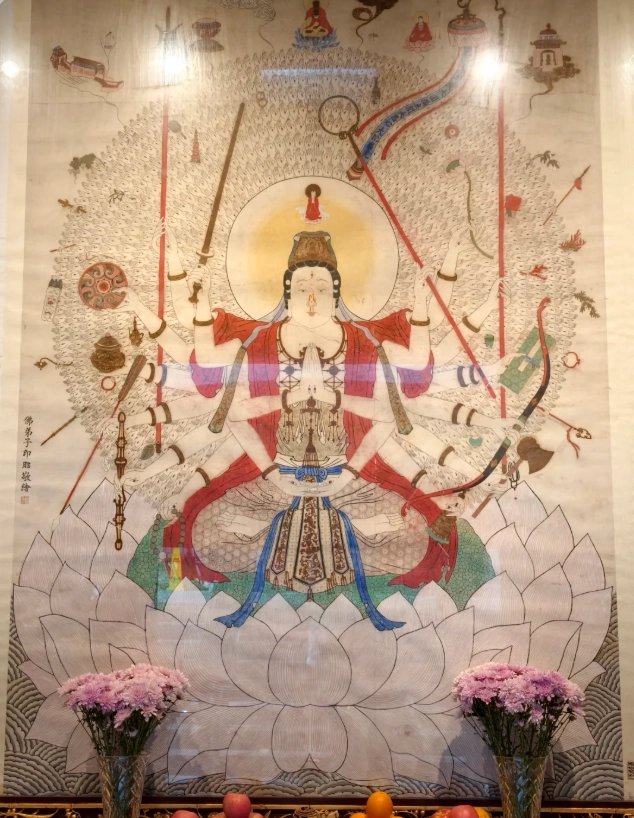
Saving Time Hacks That Actually Work
I’ve timed this dozens of times. Here’s the sequence that avoids crowds:
- 8:45 AM – Arrive at Tung Chung terminal. Buy a one-way cable car ticket (pre-booked).
- 9:15–9:30 – Board cable car (you’re among the first).
- 9:45 – Arrive at Ngong Ping Village. Walk briskly past the shops straight to the Buddha steps.
- 10:00–10:30 – Climb steps, take photos, explore top platform before the 10:30 wave arrives.
- 10:30–11:00 – Visit Po Lin Monastery (opens at 10:00).
- 11:15 – Eat at the monastery’s vegetarian restaurant (lunch starts at 11:00, beats the 12:00 rush).
- 12:00–12:30 – Walk back to the bus stop. Take bus 23 down to Tung Chung. Arrive at Tung Chung by 1:00 PM.
Alternative plan if it’s raining: Skip the cable car entirely — fog obscures views. Take bus 23 up and down (same 27 HKD each way). The bus is fully covered and takes the same route.
Final hack for photographers: The cable car ride offers stunning views of the airport and sea. Sit on the right side going up (facing the direction of travel) for the best view of the Buddha. On the way down (if you take a return cable car), sit on the left.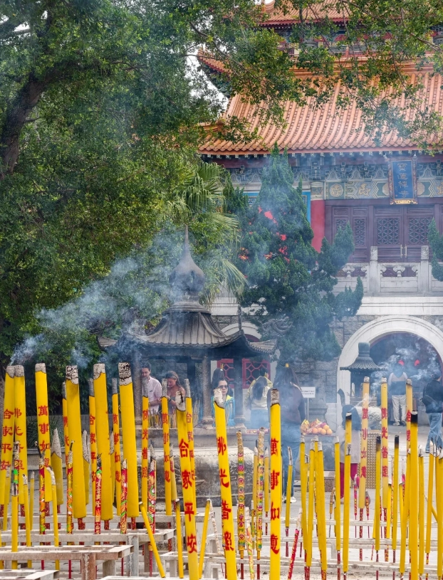
FAQ – Real Problems, Real Answers
Verified and fact-checked by the editorial team. This content has been fact-checked to ensure informational precision.
As a solo traveler who gets anxious about missing the last transport, this map was everything. It has clear markers for the bus stop, taxi stand, and the cable car terminal, plus the little notes about which route gives you the best photo lighting in the morning. I ended up taking pictures of the map itself because the illustrations are adorable. The local food suggestions were spot on—I stopped at the tofu dessert shop marked on the map and it was the best I've had in HK. Don't skip this if you're exploring Lantau on your own.
Totally worth buying before you get in line for the cable car. My gf and I used the 'Plan Like a Local' route and it was perfectly timed—we did the Big Buddha, Po Lin, and a quiet walk around the Wisdom Path, then still had time for a cold sugarcane drink at a stall most tourists walk past. The map marks the shady paths too, which was great because it was blazing hot. Nothing felt rushed. The only reason I'm writing a long review is because this little paper saved our whole afternoon. Five stars, easy.
This map was a lifesaver! I've been so many times and kept missing the trail to the Lantau South Country Park viewpoint. The map shows a shortcut behind the Buddha that links to the old stone steps—the scenery there is unreal and zero crowds. It also lists little things like where to refill water and the exact time the last Ngong Ping 360 cable car leaves. I followed every tip and had my best trip to Lantau yet. Highly recommend for anyone who wants to avoid the tourist herd.
A solid little guide if you want to see more than just the selfie spot. It points out the vegetarian lunch at Po Lin, the tea shop near the big bell, and a small side path to an old village wall that most tourists miss. I gave it 4 stars because the cable car information is a bit vague—it didn't mention that the crystal cabin line can close early on windy days. But the map itself is sturdy, waterproof, and the suggested 3-hour route worked well even with kids. Worth the few dollars.
I picked up this map at the Ngong Ping Village info counter and it was handy, but not perfect. The main landmarks—Big Buddha, Po Lin Monastery, Wisdom Path—are all clearly marked, and I liked that it showed the quieter walking route to the monks' quarters. However, a couple of the side paths were inaccurate; I ended up at a construction site when trying to follow the 'shortcut' to the bus station. Also, the print is quite small and hard to read in the humid air. Still, for the main sights it saved us a bit of backtracking, so it's an okay purchase if you're not expecting too much.
We used this map to plan the whole day and everything went smoothly. After parking at Tung Chung, we rode up in a crystal cabin and followed the circular walking route it recommends. The estimated time was spot on—about 2.5 hours without rushing. The map even marks the best place for a photo of Big Buddha from the lower platform, with the mountains framing the statue. That picture was the highlight of our trip. Grab this before you go!
I've been to Ngong Ping a couple of times but this map made me feel like a local. It includes everything from cable car queues and bus schedules to open hours for the Buddha and monastery, plus a note about Friday mornings being packed with tour groups. I followed the 'sunset walk' suggestion up to the Buddha and had the platform almost to myself. The tone is warm and personal, not like a corporate brochure. A friend's travel plan in map form.
This map saved me twice. First, by pointing out the quieter entrance to the Wisdom Path from the back of the tea garden—we almost missed it. Second, by telling me where to catch the No. 23 bus back to Tung Chung if I wanted the scenic route instead of the cable car. The local food tip for the tofu pudding cart outside Po Lin was absolutely right. It printed clearly and survived a light rain while we were up there. Highly recommend.
This map has the practical details that most tourist brochures skip. I loved the suggested route: walk straight from the Tung Chung cable car to Tian Tan Buddha before the tour groups arrive, then wander through Ngong Ping village and Po Lin Monastery on the way back. The shortcut through the car park was spot on. The only reason I'm not giving five stars is that it doesn't mention how many steps are at the Buddha or where the accessible path is. My mum couldn't climb them, and we only found out when we got there.
I really wanted to like this map because I was doing Ngong Ping for the first time. The walking times to the Big Buddha platform and Po Lin Monastery were helpful, but I got confused at the Wisdom Path turnoff—the trail marker on the map didn't match the actual signpost. It also never mentioned the construction work near the tea house, so I had to backtrack about 15 minutes. Fine for basic planning, but it needs a refresh and a bit more detail.
I normally rely on my phone, but the signal got patchy around Ngong Ping and I was glad I grabbed this map. It has clear walking time estimates, elevation notes, and the names for each viewing point along the path. I especially appreciated the local food tips beyond the usual tourist restaurants — I ended up at a tiny place I’d never have noticed. It honestly felt like having a friend who knows the area walking with me. Made my day at the Big Buddha so much more relaxed and fun.
This map was a lifesaver. We only had half a day before our flight, and the suggested route made it all work: cable car up, Big Buddha, a quick noodle bowl at the monastery, then Wisdom Path. Without it I’m pretty sure we would have wasted ages wandering around the gift shops. It even pointed out a little tea house and the best angle to frame the Buddha with the mountains behind. Worth every dollar. I’ll keep it as a souvenir too.
As someone who visits Lantau regularly, I was genuinely impressed by this map. It gives local tips that actually work: which side of the cable car to sit on for the best Buddha view, when the plaza is least crowded for photos, and where to find the quieter incense area. The hand-drawn style is charming and mine survived getting stuffed into my backpack. We saw the Big Buddha with barely anyone around and then walked over to Wisdom Path in peace. This is the kind of map I’d recommend to every day-tripper.
A solid map for first-time visitors. I liked that it showed restrooms, photo spots, and the order of sights: cable car up, Big Buddha early, then Po Lin Monastery for lunch. The only reason I’m not giving 5 stars is that the map says Ngong Ping Village is open when we got there, but most shops were still closed and we had to kill time. Also one trail marked as ‘easy’ had a surprising number of steps. Still, it helped us avoid the worst queues, and I’d recommend it with a few small caveats.
I picked this up hoping to escape the crowds and find a few quiet corners around Ngong Ping. The cable car and Big Buddha info is accurate enough, but the walking routes are too vague. It said 15 minutes to Wisdom Path and it took us almost 30 because one entrance was blocked. It also doesn’t mention the local bus alternatives when the cable car queue is insane. Honestly, the free information boards around the village give you most of the same details. Not terrible, but I didn’t find it worth the money if you have mobile data.