 Ting Chen
I still remember the first time I handed a guest a paper map at the park gate. He looked at it, then at me, and said, “This is just a cartoon.” He was right. The official map is beautiful but useless for navigation. Over six years leading tours in Shangri-La, I've learned that your phone's GPS won't save you here — Google Maps barely works, and trails aren't marked clearly. So what's the fix? A real Pudacuo National Park map with elevation notes and bus stops. And that's exactly what you'll get in this guide: a breakdown of the three zones, how to read the map, and how to avoid the sunburned, lost crowds.
Quick Navigation — What's Inside
Why You Need a Reliable Pudacuo National Park Map
Pudacuo National Park spans over 1,300 square kilometers — yes, that's huge. The park is divided into three distinct scenic zones: Shudu Lake, Bita Lake, and Militang Pasture. Shuttle buses connect them, but without a good map, you'll waste time waiting at wrong stops. Most foreign tourists rely on their phones, only to find that Google Maps shows a blank rectangle. I always tell my guests: download Apple Maps offline (it works better in China) or grab the official paper map at the visitor center. But even the paper map lacks trail difficulty ratings. That's why I sketched my own version over the years, and I'm sharing the key details here.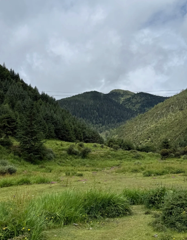
How to Read the Pudacuo National Park Map (Trails & Zones)
The official map uses colors to indicate zones — blue for Shudu, green for Bita, and yellow for Militang. Each zone has a single loop trail with boardwalks. Sounds simple? Here's the catch: the shuttle bus system is one-way. If you get off at the wrong stop, you might have to wait 30 minutes for the next bus. Let me break down each zone based on my dozens of visits.
Zone A – Shudu Lake (属都湖)
Shudu Lake is the first stop and the most popular. The loop trail is about 3.5 km, all flat wooden boardwalks. It takes 1–1.5 hours at a leisurely pace. The best part? The reflection of the mountains in the still water — absolutely Instagram-worthy. Pro tip: start your hike before 9 AM. The sun rises behind the hills, and the morning light paints the lake golden. After 10 AM, tour groups flood in, and you'll be dodging selfie sticks.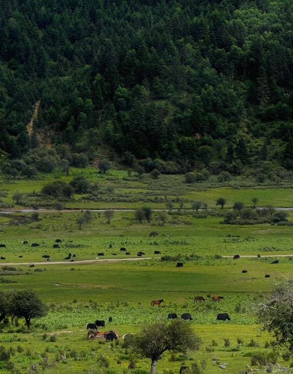
Zone B – Bita Lake (碧塔海)
Bita Lake is larger, with a 4.2 km boardwalk loop. This is my personal favorite because it's less crowded. The trail winds through rhododendron forests — if you visit in late May or June, you'll see pink blossoms everywhere. Allow 2 hours. Insider advice: the shuttle bus from Shudu to Bita takes about 15 minutes, but buses only run every 20 minutes. Check the board at the stop for the schedule (it's in Chinese, but the numbers are universal).
Zone C – Militang Pasture (弥里塘)
Militang is a high-altitude pasture at 3,700 meters. The trail is short — just 1.2 km — but the altitude might leave you breathless. The views are wide open: rolling grasslands dotted with yaks. It's a quick 30-minute stop. Honest warning: I've seen tourists rush through this zone to catch the bus back, but the real beauty is in the details — wildflowers and distant snow peaks. Take a moment to just sit on a bench. Also, there are no toilets here. Use the ones at the previous stops.
Essential Visitor Info (Tickets, Hours, Rules)
| Item | Details |
|---|---|
| Ticket Price (Adult) | 100 CNY (park entry) + 60 CNY (shuttle bus) = 160 CNY total |
| Student / Senior Discount | Students with valid ID: 50% off park entry (bus fee full). Seniors over 60: check at counter (typically half price). |
| Opening Hours | 8:00 AM – 4:00 PM (last entry). Park closes at 6:00 PM. No entry after 4 PM. |
| Booking Required | Yes, online booking is mandatory during peak seasons (May–Oct). Book via Trip.com or WeChat mini-program (Chinese only). Passport number needed. |
| Payment | Alipay and WeChat Pay widely accepted. Cash is rarely used. International credit cards? Forget it — works only at a few hotels. |
| Best For | Nature lovers, photographers, hikers (easy to moderate). Not wheelchair accessible on boardwalks. |
Important: You must bring your passport to enter — they check it against the booking. Also, the park only allows a limited number of visitors per day (around 6,000). During Golden Week (October 1–7), tickets sell out days in advance. Book at least a week ahead if you're traveling then.
How to Get to Pudacuo from Shangri-La
From Shangri-La (Zhongdian) city center, it's about 30 km to the park entrance. Taxi: around 80–100 CNY (30–40 minutes). Didi (Chinese Uber) is cheaper, about 60 CNY, but you'll need a Chinese phone number to use the app. If you're solo, consider joining a small group tour from your hostel — many hostels organize daily trips for 150–200 CNY including transport.
Bus option: There's no direct public bus. You can take local bus No. 3 to the county bus station, then transfer to a shuttle that goes near the park? Honestly, it's messy. I always recommend taking a taxi directly. Navigation warning: Do not rely on Google Maps — it will lead you to a dirt road. Use Apple Maps or the Chinese app "AMap Global" (GaoDe). Search for "Pudacuo National Park" in English; it works.
Best Time to Visit & Photography Tips
Late May to June is prime time: rhododendrons bloom, and the weather is mild. September to October offers golden autumn colors. Summer (July–August) is rainy with leeches on trails — wear long pants and closed shoes. Winter (November–March) is cold (below zero) and some trails may close due to ice. The park remains open year-round, but the shuttle bus runs on a reduced schedule in winter (last bus at 3 PM).
Golden light: For photography, arrive at Shudu Lake by 8:30 AM. The sun rises over the eastern hills around 7:30 AM in summer, so by 8:30 the light is soft and warm. After 2 PM, the lake gets harsh overhead light. At Bita Lake, the afternoon light (3–5 PM) is best for the forest shadows. And at Militang, the golden hour just before sunset (around 6:30 PM in summer) turns the grass into a sea of amber. But remember: the last shuttle bus departs from Militang at 5:30 PM, so don't get stranded.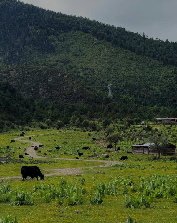
Common Mistakes to Avoid (and My Insider Fixes)
- Mistake 1: Trusting Google Maps for directions. Fix: Download Apple Maps offline or write down the Chinese name (普达措国家公园) to show taxi drivers.
- Mistake 2: Not bringing enough cash. Fix: Even though mobile payment rules, bring at least 200 CNY for emergencies (e.g., phone dies, card fails).
- Mistake 3: Skipping the shuttle bus schedule. Fix: At each stop, note the next bus time from the electronic board. The intervals vary from 15 to 30 minutes.
- Mistake 4: Wearing city sneakers. Fix: The boardwalks get slippery when wet. Wear hiking shoes with grip.
- Mistake 5: Not using a VPN. Fix: Major social media (Instagram, Facebook, WhatsApp) are blocked. Install a reliable VPN (e.g., ExpressVPN or Astrill) before your trip, or your map apps might not load.








I wanted to love this, but it left me a bit disappointed. The main trail from the visitor center to Shudu Lake is perfectly fine, but the secondary paths are almost impossible to follow – the font is tiny and some trail lines just stop without clear junctions. I also followed the ‘avoid crowds’ tip to try the less-used route near the south parking lot, but on a public holiday it was still absolutely packed, so that advice didn’t really help. The map does have basic useful info like restrooms and shuttle stops, so it’s not useless. But for the price, I expected better navigation help.
Great map overall, and it helped us navigate the park easily on a busy Saturday. The main routes were clearly marked, and the shortcut behind the visitor center saved us a lot of time. Only reason I’m not giving five stars is that the boardwalk near Shudu Lake was closed for maintenance when we visited, and the map didn’t mention seasonal closures – we had to backtrack. The alternative route shown was still beautiful, though, and the crowd-avoidance tips did help us escape the tour groups near the entrance. Definitely useful, just check current conditions first.
As someone who plans every hike down to the last switchback, I really appreciated the level of detail here. The topo lines are clean, the gradient markers match the actual trail, and the suggested times were spot on – we finished the Bita Hai loop in just under four hours, exactly as predicted. The ‘avoid crowds’ section suggested we start at the far entrance and work backwards, which felt weird at first but totally worked. I barely saw anyone until the shuttle back. Best few dollars I spent on the whole trip.
I’m not usually one to write reviews, but this map was a lifesaver on our day in Pudacuo. My phone died halfway through the hike, and the offline version kept working perfectly. The trail connections are clearly shown, and I loved that the map pointed out a quiet loop near the eastern lookout – we saw two wild pheasants and had the bench completely to ourselves. The waterproof paper was also a nice touch since it started drizzling near the lake. Highly recommend grabbing this before you go.
Honestly, this map turned a chaotic trip into one of my favorite hikes ever. I used the crowd-avoidance tips to skip the main boardwalk at Shudu Lake and take the western edge of Bita Hai instead. Within ten minutes, we had the trail to ourselves – just the sound of wind through the pines and a few ducks gliding over the water. The elevation markers are accurate, and the restroom icons saved us more than once. If you want to actually enjoy Pudacuo without being jostled by tour groups, buy this.
Beautifully designed trail map! I’ve used a lot of park maps, and this one actually respects hikers — it gives real distances, not just “short walk” vague nonsense. The elevation profile for the Lishu section was crucial for my knee brace decision, and the crowd-avoidance tips meant we skipped the packed lakeside pier and did the elevated forest loop instead. Misty pines, zero crowds, and a map that never steered me wrong. Absolutely worth it.
As a solo traveler, I usually just wing it, but I’m glad I grabbed this map before heading into Pudacuo National Park. It clearly marked the shuttle stops, rest areas, and photography spots, which made my day feel relaxed instead of rushed. The “avoid crowds” side is genius — I waited until the tour buses left and then took the lower trail. Saw pheasants and not a single loud group. Five stars for making an introvert’s dream trip happen!
This map was a lifesaver! We had no phone signal inside Pudacuo, and the map’s simple color-coded trails kept us on track without stressing. The little notes about which boardwalk sections get congested before 10am were spot on — we walked straight past the tour groups and had the lakeside viewpoint almost to ourselves. Highly recommend folding it into your fanny pack and going early!
Solid map overall. The highlighted loop around Bitahai saved us from wandering onto a dead-end path, and the estimated times were pretty accurate. I wish the font was larger and there were more elevation markers, but the “quiet trail” alternative near the boardwalk was a nice touch. We only saw a handful of other hikers there. Good buy for the park, just not perfect.
I really wanted to love this map, but it fell a bit short for me. The trail markings were clear enough, but the paper got soaked within ten minutes of light rain at the first viewpoint. Also, the “avoid crowds” tips felt like they were written pre-COVID — we still hit big groups at Shudu Lake even using the suggested early route. It’s not useless, but for the price I’d expect a waterproof version and more current advice.